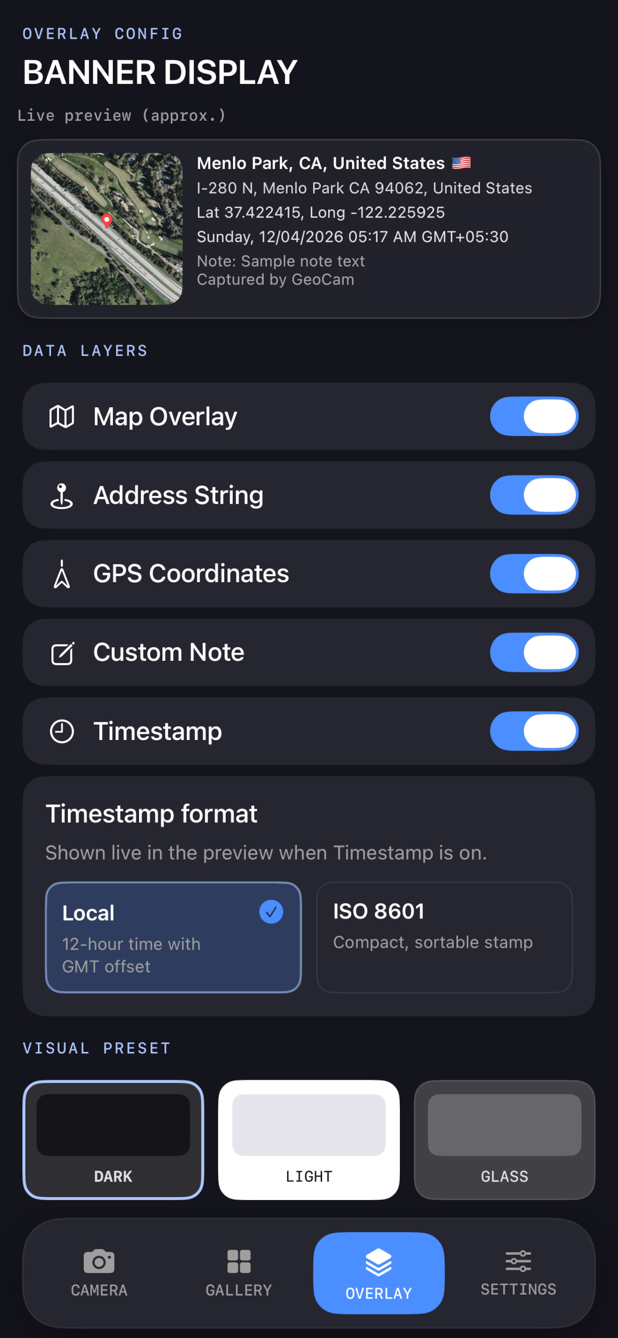
Live banner
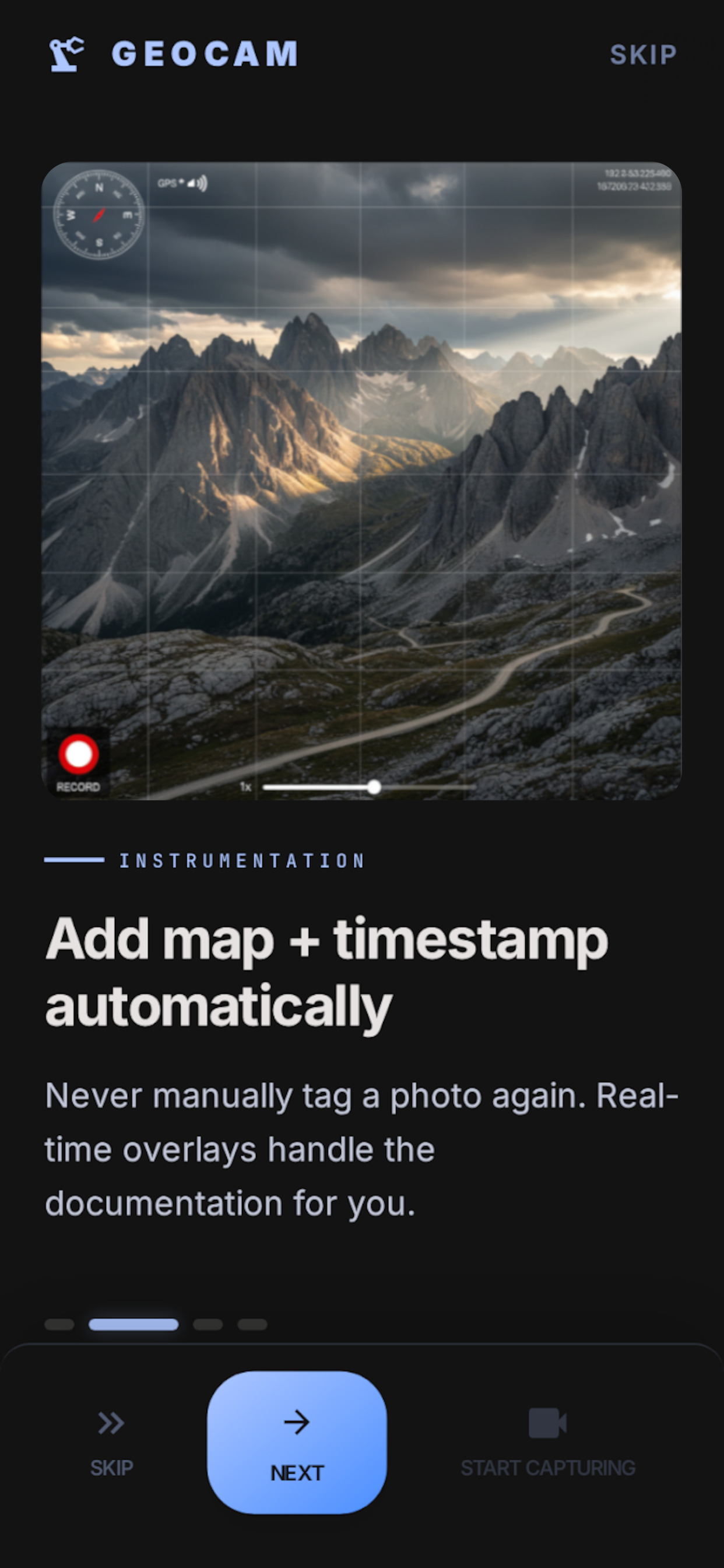
Map snapshot, street-level address, lat/long, and timestamp. Toggle layers, map styles (standard, satellite, hybrid, terrain), and dark, light, or glass presets.
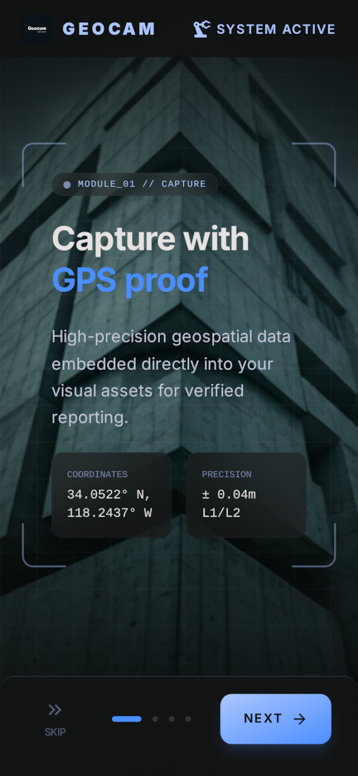
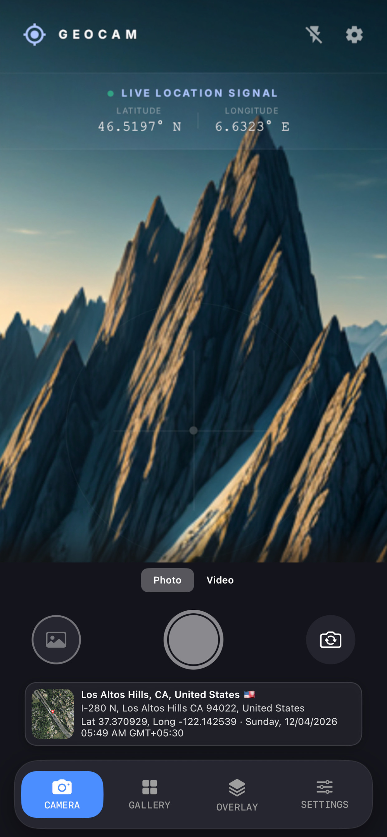
Prove where and when it happened before you tap the shutter. Live map, coordinates, and time on your preview, carried into every photo and video so your field records ship with defensible location context.
Instant acquisition of high-res field imagery with synced GPS locking.
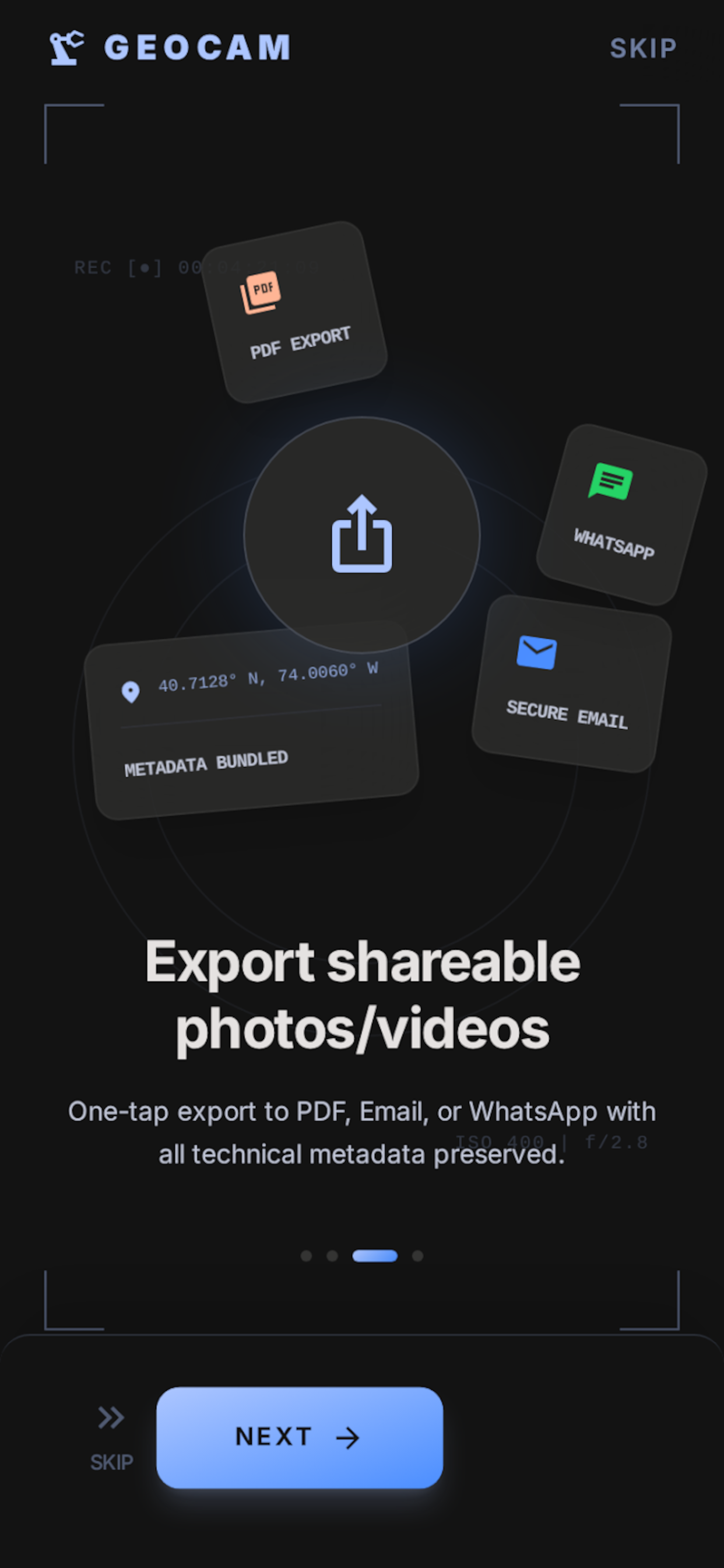
Automated overlay of technical data, watermarks, and project identifiers.
One-tap export of verified media packages and geospatial reports.
Camera, gallery, overlay, and settings, tuned for documentation in the field. Map and geocode updates are throttled to balance accuracy with battery and API load.
Map snapshot, street-level address, lat/long, and timestamp. Toggle layers, map styles (standard, satellite, hybrid, terrain), and dark, light, or glass presets.
Full-resolution capture, then composite the banner under the picture. Save to your library with location and EXIF where the platform allows.
Banner on preview while recording so context stays visible. Saved file is not watermarked; location is stored in library metadata when you save.
Aspect ratios (1:1, 3:4, 9:16, full sensor), resolution tiers, self-timer (3s / 5s / 10s), and appearance that matches your system or preference.
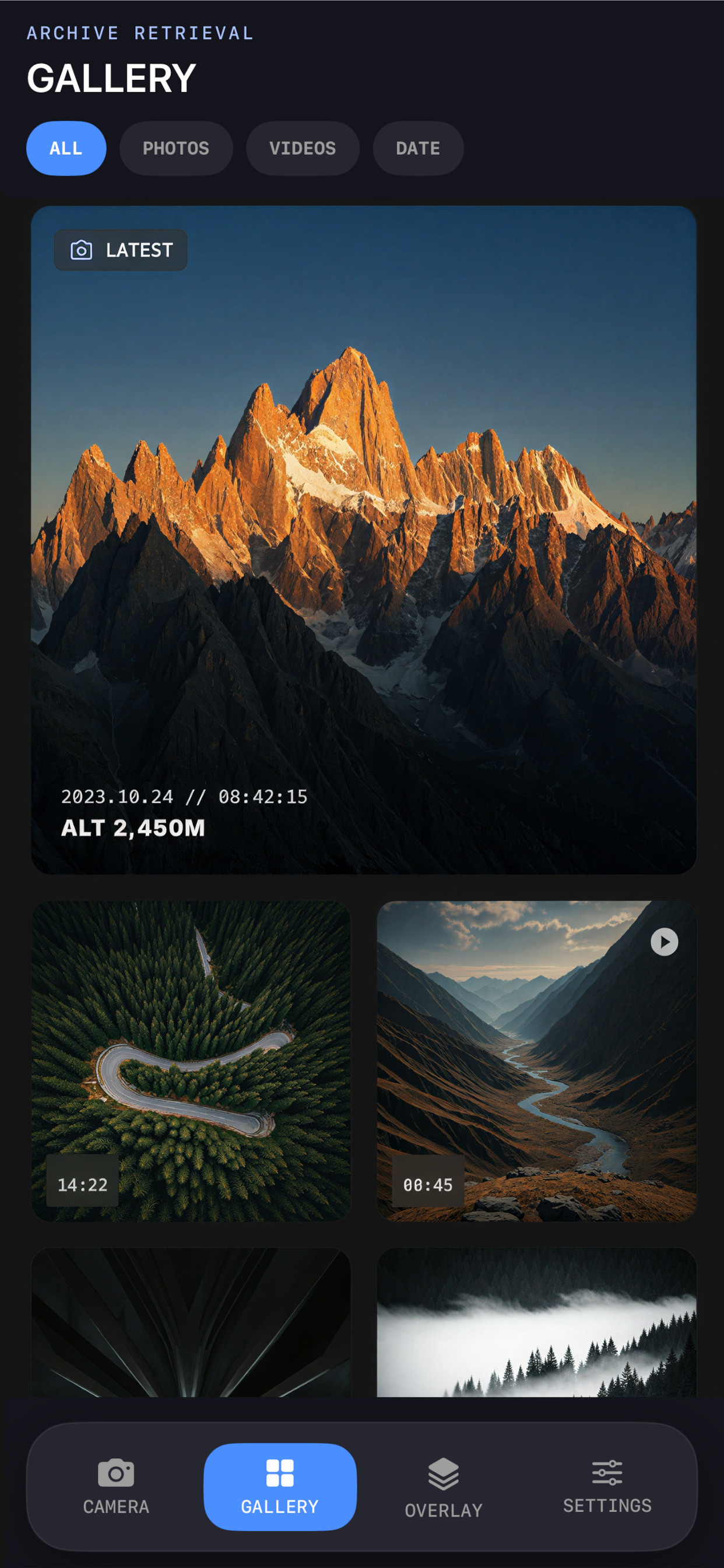
Browse what you captured here: filter photos and videos, jump by date, open details, and share where supported.
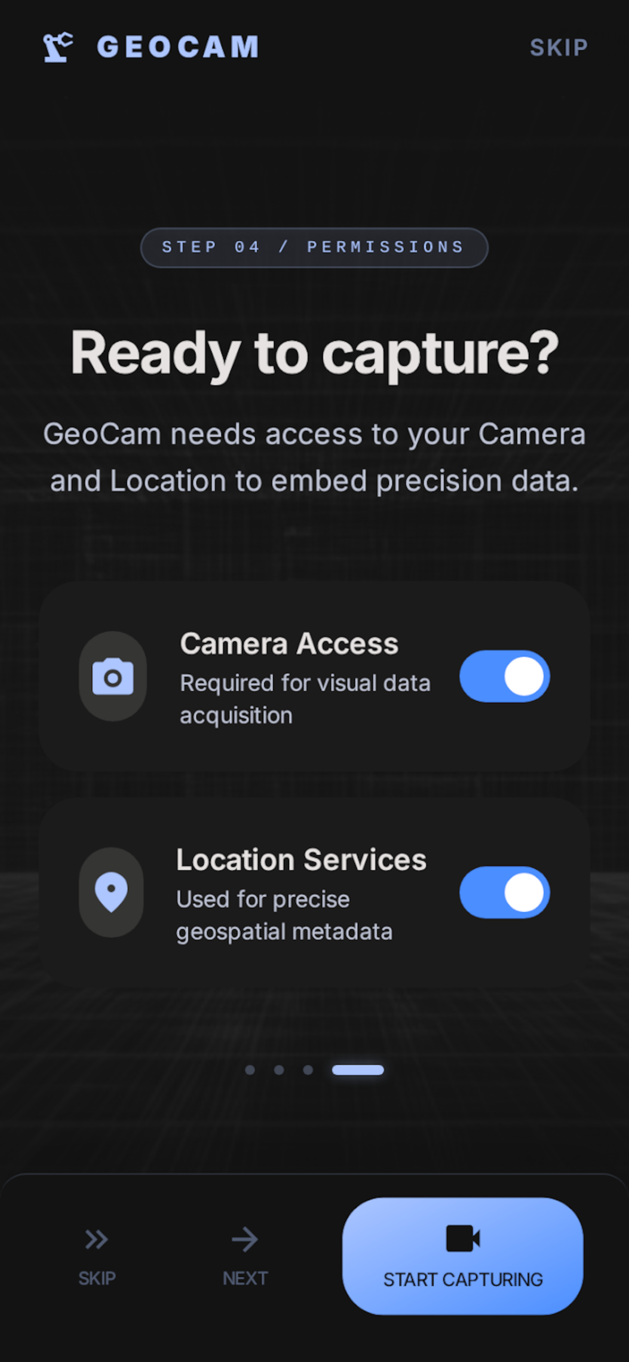
No account required. Location is used while you use the app; see our Privacy Policy and Terms of Service for details on permissions, ads, and use of the app.
Real screens from GeoCam. Outcome-led captions match how teams use the app in the field.
Join 50,000+ professionals using GeoCam to document the world with tactical accuracy.